
 Sampling Strategy and Coverage
Sampling strategy
Ocean Thematic Centre (OTC) coordinates and supports the European network of Monitoring Stations Assembly (MSA) in the Atlantic Ocean, including the North, Barents, Baltic and Mediterranean Seas. OTC aims to cover the global ocean observing systems, such as Ships of Opportunity (SOOP) and Fixed Ocean Stations (FOS). To constrain air-sea ocean fluxes over the entire regions such as the North Atlantic, the observational data is interpolated to these regions by combining with satellite measurements of surface temperature, winds and the output of real-time ocean forecasting models.
The SOOPs are commercial ships operating regularly repeated routes, e.g. ferry routes in European shelf and marginal seas, cargo vessels on open ocean routes, and research vessels operating both coastal and open ocean. The FOSs are fixed sites in the ocean at which sustained time series observations are recorded by means of moorings and buoys monitoring.
The SOOPs and FOSs are equipped with a range of automated instrumentation to measure atmospheric and surface ocean pCO2, surface temperature, surface salinity and related variables. Measurements are performed along transects and at fixed positions at intervals of days to months.
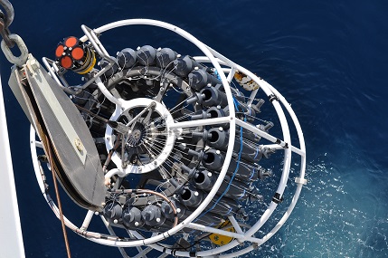
In addition to the core platforms mentioned above, OTC aims to include Repeat Ocean Sections (ROS) in the observational network to achieve optimal coverage. ROS are full depth sections obtained at scientific cruises and analysed using standard instrumentation for carbon system variables. The sections are typically visited every 5 years.
OTC works with the wider community to develop new sensors for the carbon system for autonomous platforms such as Argo floats and gliders, to provide better coverage of more remote areas.
Spatial coverage
The ocean community of ICOS focuses on the Atlantic Ocean and adjacent seas. The linear coverage along ships tracks is integrated with satellite-based observations and modelled data to provide extrapolation across the surface of the ocean. The satellite data is also used to assist the interpolation of the data between passages of the ships. Carbon flux estimates are based on ships and satellite measurements of surface temperature, winds and the output of real-time ocean forecasting models.
Carbon exchange between the surface ocean and the atmosphere cannot be understood without considering the contribution to the carbon fluxes of mixing from the surface into deeper waters. Therefore, there is a need for cooperation with:
(1) the Argo float community to ensure that information on changes in thermocline and deep-water mixing are available.
(2) CLIVAR (Climate Variability and Predictability) community such as GOSHIP, to ensure that information of transport and storage of carbon within the ocean is linked with surface measurements and air-sea fluxes.
Temporal coverage
The SOOPs typically measures semi-continuously, while the temporal coverage at FOSs ranges from semi-continuously to annually.